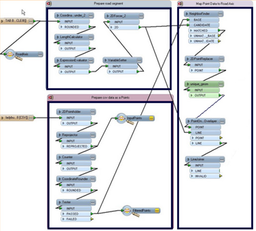
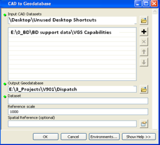
Geospatial Data Migration is the process of transferring data between format types, generally data migration is used when upgrading to technology. Migration of CAD, arcinfo, shape and raster formats to other geospatial data formats(popular) by automatic methods. VGS has capability to customize the migration process s and able to deliver the quality output.